Friday, June 24, 2016

Pig's Eye Lake Park

This photo is off Pig's Eye Lake Road.
Pig's Eye Lake Park is, I believe, the largest park in St. Paul and also the least visited due to access problems. The park has been expanded to include a number of regions. The largest section is by the city's sewage treatment plant on Childs Road; just before the plant, there is a hard-to-see turn that takes one around the plant and there is a small region not marked "Private Property" or "No Trespassing" that belies the huge expanse behind it. There is another entry, almost as difficult to use, on Pig's Eye Lake Road; just past the wood exchange is a low-lying area (often a pond) with just enough space to turn a car and is adjacent to private property marked "no trespassing." The former fish hatchery lands, controlled by the DNR (which has an office next to it) has an archery range being built on the north end, just off the Sam Morgan trail at Warner Road. From Battle Creek Park, one can take the Sam Morgan trail, as well, to the east side of Pig's Eye Lake. Two more sections, completely unconnected to the others by land can be reached only from Red Rock Road; one is the very end of that road, the other is the pond/wetland on the east side of the road.

Sam Morgan Bicycle Trail

This trail sign is south of Warner Road
The Sam Morgan bicycle trail is a paved path that runs through Battle Creek Park, along Pig's Eye Lake, Warner Road and the Mississippi River, before connecting with other paths. It's popular with bicycle commuters, but relatively unknown to others.

Swede Hollow Park

This large park is easily missed, as access is limited, due to being mostly in a deep ravine. The part not containing the Bruce Vento Trail is west of Greenbrier Street and south of Beech. There is a long stairwell (13 flights) down to the rest of the park near Bates Street.

Eastview Heritage Park

Oops. Camera was set for a close-up.
This new park was created on the north side of Phalen Boulevard, south of Wells Street, betwen Arcade and Edgerton Streets (at, I think, Neid Lane, a new road). There is a picnic area, some gardens and a kiosk pointing the way to other amenities.

Payne Avenue Triangle

This small triangle is located where Payne Avenue meets North Street. A monument to fallen police officers and plantings have improved this once grassy plot.

Bruce Vento Regional Trail

This paved bicycle trail runs from where it connects to other trails near the Bruce Vento Nature Preserve, along Swede Hollow, Phalen Boulevard and Phalen Lake, then continues north to Maplewood and beyond. The prominent sign (and parking lot) is on east 7th Street at Payne Avenue.

Hamm Park

The bronze plaque on this rock was stolen.
Hamm Park (not to be confused with another park formerly with a similar name) is north of East 7th Street at Greenbrier.

Forest Street Triangle

Located across the street from where the original 3M complex was, this triangle is on the south side of East 7th Street, west of Forest Street.

Arlington Playground (and Sue's Park)

Between Edgerton and Greenbrier and between Maryland and Geranium, this playground was recently expanded and includes a public library attached to the new recreation center building. The former Sue's Park (with its fountain and picnic table) at Rose and Edgerton was eliminated in the expansion, but may still be on some maps.

Maryland Westminster Pond

This small fenced-in holding pond was created during recent work on Interstate I-35. South of Maryland, west of Westminster, it is in a conspicuous location, yet easily overlooked.

Westminster Mississippi Stormwater Pond

Located beside Interstate I-35, this pond is south of Hyacinth Street and west of Westminster. It appears to have been created as part of a recent highway upgrade.

Arlington/Arkwright Park and Pond

Named for the roads at its northwest corner, this park is best known for its large off-leash dog park. There are the other usual facilities and, across Arkwright there is a large holding pond that does not appear to be part of the actual park.


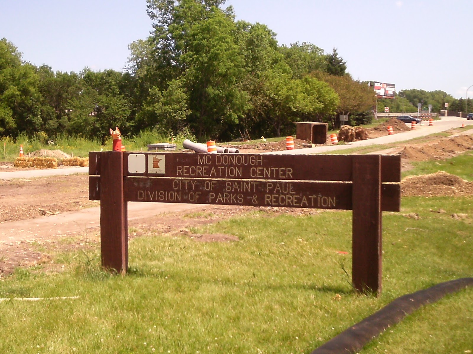
McDonough Rec Center

Not to be confused with McDonough Park, which is on the opposite end of town, this Rec Center is just off Interstate I-35, at Wheelock Parkway and Klainert Street. When the photo was taken, there was a major construction project underway.

Wheelock Parkway Garden Triangles

There are two triangles where Parkway Drive intersects Wheelock Parkway at Edgerton Street. One has recently had a rather nice garden planted. There is a second pair of triangles, listed separately, where Wheelock intersects Greenbrier and Walsh streets.

Railroad Island Garden

This small triangle is adjacent to Eileen Weida Park, where Lafayette Street and Tedesco Streets meet. The actual garden seems to have shrunk slightly in recent years.

Eileen Weida Park

Named for Railroad Island neighborhood activist Eileen Weida, this used to be called the Lafayette Playground. It is between Tedesco and Fred Streets and between Desoto and Burr.

Monday, June 20, 2016

Pike Island

Expand the photo and Charlie's under the sign.
Pike Island is part of Fort Snelling State Park, but is the only part of the park that is within the boundaries of St. Paul. So, to get to it by land, you have to go through Minneapolis, one of the more interesting quirks of the parks of the city.

Friday, June 3, 2016

Highwood Hills Park

Highwood Hills Park is located to the east and south of the adjacent elementary school off Londin Lane, next to Totem Town. It's difficult to say just what is in the park - I believe the tennis courts, the athletic field and the parking lot are, the playground equipment probably is and the community garden and compost site are questionable.

Henry Park

Henry Park is a new (and apparently contentious) park n the southeast corner of St. Paul. The entrance - a closed gate - is on Skyway Drive, a rough dirt road off of Highwood Avenue. There is a loop walking path in the woods, skirting neighboring properties with prominent property boundary markers. Every time I've gone there, the neighbors have watched me closely.

Fish Creek Park

This is the very end of the creek before it passes under Hwy 61.
Fish Creek is a very large new park on the very southern edge of St. Paul, which incorporates what were Carver Avenue open spaces and newly-acquired land. Fish Creek has few, if any fish; it was named for a Mr. Fish. It can be entered from either the west, off Highway 61 (the nearby church is a good place to park; paths into the woods are easily found behind the church) or from the north, off Carver Avenue. I believe there's an entrance off Henry Lane, as well. The eastern portion has hills with vistas, the western end is heavily wooded with a path along the creek.

Mississippi River Bluff Preservation Open Spaces

Charlie's at the entrance to this easily-missed path.
There are a dozen open spaces in this set, some owned by the parks department, some are tax-forfeit lands not yet incorporated. Many are difficult to find. The majority of them are empty lots along the right-of-way to the unimproved Mystic Street and Piedmont Street right-of-ways, which have a few entry points the neighbors would rather you didn't know. Where the paved section of Mystic Street appears to dead end in a driveway, most of the driveway is public land and there is a path entrance at the end of it. There is another entrance to Mystic Street from the Highwood Preserve. There's a theoretical entrance on the unimproved Piedmont Street, but the space is patrolled by a dog who doesn't care that you technically have a right to go there. The easiest entrance is between #533 and #545 Burlington Road, near a fire hydrant, where two paths enter the woods; these are easiest to see in early spring and late fall.

Here's my notes to all locations (a city park map will help):

1) btwn 533 and 545 Burlington
2) east of 674 Pt. Douglas
3) east of 700 Pt. Douglas (north of Elmwood)
4) east of 738 Point Douglas, north of 2051 Howard Ct.
5) Springside Drive east of 2077, west of 799 Winthrop (stormwater pond)
6) south of 2034 Pt. Douglas
7) east, across from, 2090 to 2116 Highwood
8) 2120 Skyway Drive (part of Henry Pk?)
9) south of 2082 skyway, across from 2087.
10) west (behind) 2100 Skyway
11) Lower Afton Rd, 300 ft. east of Battle Creek Rd, west of #281
12) lower Afton Rd, 300 ft. east of Point Douglas, between 432 Pt. Douglas and 405 Burlington, north of 409 Burlington
13) from alley west of 450 Burlington, east of 464 Pt. Douglas (@bend in road) to east of 482 Pt Douglas (north of 471 Mystic)

Highwood Preserve

Entrance to the preserve

From the highest point, one can see across the river.
This is one of the best-kept secrets of St. Paul, an open space reached from the southern edge of Taylor Park by a set of stairs. If one keeps to the path skirting the woods, one comes upon the Mystic Street right-of-way, which also leads to the next entry on this blog.

Taylor Park

Located in a quiet neighborhood south of Battle Creek, this park is reached by turning off Burlington Road (itself most easily reached from McKnight Road) on to Howard Street.

Battle Creek Park

Battle Creek is one of the largest parks in St. Paul, probably known best for its limestone cliffs with shallow caves, near the parking lot off of Highway 61.

Wildview/Lenox Stormwater Pond

Camera problems, unfortunately.
As its name suggests, this pond is located near the intersection of Wildview and Lenox Streets in the southeast corner of the city. Located on a hill, it's a surprise to find. Ramsey County plat maps suggest the pond is privately owned, but the sign I tried to capture in the photo shows the city claims it. It's very pretty and worth a detour if in the area.